Drafting, Surveying, and Mapping Instruments
Federal Supply Class (FSC: 6675
NATO Supply Classification Class (NSC): 6675
Group Description: Instruments and Laboratory Equipment
Federal Supply Group (FSG): 66
NATO Supply Classification Group (NSG): 66
Page 1 of 54
Includes Drawing Instruments, Drafting Tools; Engineering and Architectural Scales; Levels; Transits; Photogrammetric Instruments; Astrolabes; Level Rods; Plane Tables; Surveying Altimeters; Theodolites.
Excludes Surveyors' Tapes.
Note-Infrared assemblies (including sub-assemblies and components) designed specifically for use as or with instruments and laboratory equipment are included in the classes of this group. Also included are computers (including computer assemblies, computer systems and components) designed specifically for use with instruments and laboratory equipment.
 Additional Information for Drafting, Surveying, and Mapping Instruments
NATO Supply Class 6675 is a classification within NATO Supply Group 66, which is dedicated to Instruments And Laboratory Equipment.
NATO Supply Class 6675 specifically focuses on Drafting, Surveying, And Mapping Instruments. This class includes a wide range of instruments used for various purposes related to drafting, surveying, and mapping activities.
Some examples of instruments that fall under this class include:
1. Drafting instruments: These are tools used for precise drawing and drafting, such as compasses, rulers, protractors, and drafting machines.
2. Surveying instruments: These instruments are used for measuring and mapping land, including theodolites, total stations, levels, and GPS receivers.
3. Mapping instruments: These instruments are used for creating maps and charts, including map plotters, map measurers, and map rulers.
4. Photogrammetry instruments: These instruments are used for measuring distances and angles from photographs, such as stereoplotters and photogrammetric cameras.
5. Geodetic instruments: These instruments are used for precise positioning and measurements on the Earth's surface, including geodetic theodolites and GPS surveying equipment.
It is important to note that NATO Supply Class 6675 is specifically designed for military and defense purposes within the NATO organization. These instruments are used by military personnel for various applications, including military engineering, reconnaissance, and mapping activities.
If you need more specific information about any particular instrument or have any other questions, feel free to ask!
NSN by Country
Frequently Asked Questions(FAQ) for Federal Supply Class 6675
- What is Federal Supply Class 6675?
- FSC 6675 is the Federal Supply Class(formally known as NATO Supply Classification Class NSC 6675) in the USA for supply items codified in the category of Drafting, Surveying, and Mapping Instruments.
- What is NATO Supply Classification Class 6675?
- NSC 6675 is the NATO Supply Classification Class (also known as Federal Supply Class FSC 6675 in the USA) for supply items codified in the category of Drafting, Surveying, and Mapping Instruments.
- Which Federal Supply Group is FSC 6675 in?
- FSC 6675 is in Federal Supply Group(FSG) 66 which contains .
- Which NATO Supply Classification Group is NSC 6675 in?
- NSC 6675 is in NATO Supply Classification Group(NSG) 66 which contains .
Supply Items Included in Federal Supply Class 6675
- What is a Surveying Target Set? 32 Items
- A Surveying Target Set (TARGET SET,SURVEYING) is a collection of surveying equipment, such as targets, reflectors, and tribrachs, which may be provided with electrical illumination and used in precise traversing.
- What is a Draftsman's Ruling Pen? 67 Items
- A Draftsman's Ruling Pen (PEN,RULING,DRAFTSMAN'S) is an instrument having two or more blades, usually of steel, which are fixed or replaceable. They are attached to a handle at one end, the other ends being pointed. The distance between the points is adjustable. It is used in drafting for inking lines.
- What is a Pivot Drafting Compass? 168 Items
- A Pivot Drafting Compass (COMPASS,DRAFTING,PIVOT) is an instrument consisting of two branches or legs joined at one end by a pivot, one leg having a needle point, the other a writing point. It is used for drawing circles. Points for use as dividers may be included, but at least one writing point must be included. For compass type dividers, see DIVIDERS, DRAFTING, PLAIN.
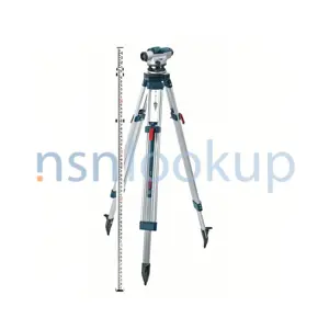
- What is a Surveying Tripod? 312 Items
- A Surveying Tripod (TRIPOD,SURVEYING) is a three legged device for holding or supporting various types of surveying instruments or equipment with the legs hinged to the top or head.
- What is a T-Square? 83 Items
- A T-Square is a tool having a fixed or swivel head or crosspiece normally attached at a right angle to the end of a straight edge or blade. It is used as a guide for drawing straight lines in drafting.
- What is a Drafting Triangle? 191 Items
- A Drafting Triangle (TRIANGLE,DRAFTING) is a thin, flat, plane, or graduated triangular piece of celluloid, wood, or metal, usually having a right angle and varying adjacent angles, or two attached triangles or graduated arms which may be adjusted to angles of various degrees. It is used as a guide for drawing lines. Excludes items punched as templates or line guides.
- What is a Parallel Ruler? 71 Items
- A Parallel Ruler is a tool for drawing a line parallel to another, or a series of parallel lines as a nongraduated flat straightedge, having two beveled edges running on a pair of rollers mounted in one of its sides or a pair of straightedges connected by two parallel links so that only one straightedge can be moved parallel to the other. Excludes STRAIGHTEDGE, PARALLEL RULING, GUIDE CORD.
- What is a Bench Mark? 48 Items
- A Bench Mark is a metal tablet, usually set in a concrete base or fastened to a permanent structure or boulder used as a reference point in surveying.
- What is a Drawing Board? 112 Items
- A Drawing Board is a square or rectangular fabricated object, usually of wood, having at least one squared end and a flat smooth surface to which paper can be affixed for use in drafting. See also DRAWING BOARD AND TRESTLE; DRAFTING MACHINE AND DRAWING BOARD; PLANE TABLE BOARD; and SKETCHING BOARD.
- What is a Level Rod? 149 Items
- A Level Rod (ROD,LEVEL) is a strip of wood, metal or flexible material having graduations on one or both flat surfaces, used with a surveying level to measure vertical distances between points on a vertical plane, and the line of sight of the level.
- Protractor,Circular 78 Items
- Protractor,Semicircular 102 Items
- What is a Map Measurer? 23 Items
- A Map Measurer (MEASURER,MAP) is an instrument having a tracing wheel attached to a watchlike case with a dial, with or without a handle. It is used for measuring roads, contours, and other irregular lines on maps, charts, and the like.
- What is a Surveying Alidade? 22 Items
- A Surveying Alidade (ALIDADE,SURVEYING) is an instrument consisting of a sighting device mounted on a graduated base, used for plotting the lines of a survey directly from observation.
- What is an One Arm Protractor? 23 Items
- An One Arm Protractor (PROTRACTOR,ONE ARM) is a protractor having a circular or semicircular shape with a movable arm or straight edge for extending graduations on protractor either for drawing lines or locating a point. Excludes PROTRACTOR, MECHANICS, BEVEL and PROTRACTOR, MECHANICS, PLAIN.
- What is a Three Arm Protractor? 27 Items
- A Three Arm Protractor (PROTRACTOR,THREE ARM) is a protractor having two movable and one stationary arm. Excludes PROTRACTOR, MECHANICS, BEVEL and PROTRACTOR, MECHANICS, PLAIN.
- What is a Surveying Level? 190 Items
- A Surveying Level (LEVEL,SURVEYING) is an instrument consisting of a leveling and sighting device, used for general topographic measurements, such as determining and delineating the form, extent or the like, of a tract of land. It is manually adjusted. Excludes CLINOMETER, ELEVATION AND DEPRESSION, SURVEYING and LEVEL, OPTICAL, AUTOMATIC.
- What is a Range Pole? 96 Items
- A Range Pole (POLE,RANGE) is a straight slender piece of wood or a metal tube, used for sighting lines or points in surveying.
- What is a Surveying Arrow? 33 Items
- A Surveying Arrow (ARROW,SURVEYING) is a metallic pin or rod pointed at one end, having a loop or eye at the other end, used to stick in the ground at each chain or tape length in land surveying.
- What is a Drawing Board Trestle? 15 Items
- A Drawing Board Trestle (TRESTLE,DRAWING BOARD) is a braced-frame forming the whole support of a drawing board.
- What is a Drafting Scriber? 30 Items
- A Drafting Scriber (SCRIBER,DRAFTING) is a device for scribing impressions of letters, symbols, characters, and lines with an etching point, by means of guides, templates, or free hand. Excludes SCRIBER, LETTERING.
- What is a Lettering Scriber? 26 Items
- A Lettering Scriber (SCRIBER,LETTERING) is a device for tracing letters and characters with either a pen or pencil point by means of a guide or template.
- What is a Pantograph? 57 Items
- A Pantograph is an instrument used for reducing and enlarging the outline of a drawing, map or draft by means of adjustable arms.
- What is an Integrator? 50 Items
- An Integrator is a mechanical device for ascertaining the area and moments relative to any axis of any figure by tracing its outline.
- What is a Planimeter? 34 Items
- A Planimeter is an instrument designed to ascertain by simple mechanical operation the area of any plane surface represented by a figure such as indicator diagrams, profile plans, sections.
- What is a Drafting Machine? 158 Items
- A Drafting Machine is an instrument primarily used in drafting, consisting of two joined arms, one end being secured to a stationary surface and the other end equipped with an adjustable protractor and removable ruled scale(s); or two rigid beams, one beam anchored across full length of top of drawing board, the other beam perpendicular to top beam equipped with adjustable protractor and removable ruled scale(s). It is used as a guide for drawing parallel lines at any angle on a chart or drawing, or transmitting reference points.
- What is a Sketchmaster? 13 Items
- A Sketchmaster is a device for transferring an image from one medium to another, as from an aerial photograph to a map sheet.
- What is a Surveying Altimeter? 34 Items
- A Surveying Altimeter (ALTIMETER,SURVEYING) is a barometric type instrument consisting of a pressure sensitive element which contracts or expands in proportion to atmospheric pressure, connected through a linkage to a pointer. Its dial is graduated in units of linear measurement (feet, meters, and the like), to indicate differences of elevation only. Excludes ALTIMETER, PRESSURE.
- What is a Drafting Template? 417 Items
- A Drafting Template (TEMPLATE,DRAFTING) is a thin transparent sheet of plastic or similar material, having cut out portions outlining some definite objects, symbols, or geometrical shape(s). Excludes TEMPLATE, LETTERING.
- What is a Straightedge? 112 Items
- A Straightedge is a bar or slip of wood, metal, or plastic, having one or more long edges made straight within a desired degree of accuracy. It is used for testing straight lines or surfaces, drawing straight lines, and the like. Straightedges having one beveled edge may be graduated on the beveled edge. Excludes STRAIGHTEDGE, PARALLEL RULING, GUIDE CORD; SCALE (as modified); RULE (as modified) and RULER (as modified).
- What is a Proportional Drafting Dividers? 32 Items
- A Proportional Drafting Dividers (DIVIDERS,DRAFTING,PROPORTIONAL) is an instrument consisting of two branches or legs which are pointed at both ends and joined by a sliding pivot, the position of which may be so adjusted that the ratio of the distance between one pair of points and the pivot and the distance between the other pair of points and the pivot may be varied. This combination produces the variable ratios. Used for making proportional transfer of measurements.
- What is a Beam Drafting Compass? 46 Items
- A Beam Drafting Compass (COMPASS,DRAFTING,BEAM) is an instrument consisting of two or more clamps which may be attached to a beam so that the distance between them may be varied. One of the clamps holds a needle point, and the other a writing point. It is used for drawing circles. Points for use as dividers may be included.
- What is a Stadia Rod? 35 Items
- A Stadia Rod (ROD,STADIA) is a strip of wood, metal or flexible material having graduations, symmetrical designs, or patterns on one or both of the flat surfaces. It is used with a surveying instrument to measure ground distances.
- What is a Plain Drafting Dividers? 81 Items
- A Plain Drafting Dividers (DIVIDERS,DRAFTING,PLAIN) is an instrument consisting of two or three branches or legs joined at one end by a pivot and being pointed at the other end. Used for transferring measurements. Does not provide means for drawing circles.
- What is a Drafting Scale? 291 Items
- A Drafting Scale (SCALE,DRAFTING) is a thin, flat or triangular strip of wood, plastic, or other material, with one or more edges, graduated in common units of linear measurement (inches, centimeters, feet, yards, or meters), which are subdivided into fractional or decimal parts of the unit. Generally used in drafting for measuring distances. Excludes SCALE, PLOTTING and RULE (as modified).
- What is an Irregular Drafting Curve? 120 Items
- An Irregular Drafting Curve (CURVE,DRAFTING,IRREGULAR) is a thin flat piece of metallic, plastic, or similar material having one or more edges used as a guide for drawing curves, all portions of which are not subject to the same mathematical formula.
- What is a Level Rod Level? 69 Items
- A Level Rod Level (LEVEL,LEVEL ROD) is a small device consisting of a level vial or vials mounted in a bracket which is held against or fastened to a level rod to determine whether the rod is being held in a vertical position.
- What is a Plane Table Board? 13 Items
- A Plane Table Board is a rectangular or square device made of wood with provisions for attaching to a ball and socket tripod head for holding maps or drawing paper. It is used in conjunction with an alidade for surveying and topographic work. Excludes DRAWING BOARD and SKETCHING BOARD.
- Case,Drawing Board And Plane Table Board 10 Items
- Case,Drafting Instrument Set 26 Items
- What is a Plotting Scale? 220 Items
- A Plotting Scale (SCALE,PLOTTING) is a thin, flat or triangular shaped strip of wood, plastic or other material with one or more edges graduated in units applicable only for the plotting of distances represented by the map ratio printed on the scale. The scale may contain one edge graduated on a 1 to 1 ratio. Used for plotting or measuring distances on maps, charts, and the like. Excludes SCALE, DRAFTING and RULE (as modified).
- What is a Level Sight? 12 Items
- A Level Sight (SIGHT,LEVEL) is an item consisting of two separate mounting brackets, one having an aperture with cross hairs, the other with a plain aperture; or each with a fitted device with such apertures. It is attached to a level or straightedge and is used as an inexpensive substitute for surveyors' instruments to level and align walls, grades, fences, and the like. See also LEVEL, SURVEYING.
- What is an Adjustable Curve Drafting Ruler? 21 Items
- An Adjustable Curve Drafting Ruler (RULER,DRAFTING,ADJUSTABLE CURVE) is a flexible ruling device for drawing desired curves in drafting. It does not require weights or fasteners to retain its various shapes.
- What is a Surveying Elevation And Depression Clinometer? 42 Items
- A Surveying Elevation And Depression Clinometer (CLINOMETER,ELEVATION AND DEPRESSION,SURVEYING) is an instrument consisting of an arc scale mounted within a circular case. It is used for measuring angles of elevation and depression. Excludes LEVEL, SURVEYING.
- What is a Surveying Vertical Collimator? 18 Items
- A Surveying Vertical Collimator (COLLIMATOR,VERTICAL,SURVEYING) is a telescopic instrument which enables an observer to look in a horizontal direction and see a point vertically overhead. May be equipped with an additional telescope enabling observation of a point vertically downward.
- What is an Elevation Clinometer? 46 Items
- An Elevation Clinometer (CLINOMETER,ELEVATION) is an optical instrument consisting of a sighting tube and a quadrant scale plate, used to ascertain the angle of elevation of an object.
- What is a Surveying Instrument Trivet? 24 Items
- A Surveying Instrument Trivet (TRIVET,SURVEYING INSTRUMENT) is a device with three short, unadjustable legs integral with the body on which surveying equipment or instruments may be mounted.
- What is an Aerial Photograph Interpretation Lens-Mirror Stereoscope? 20 Items
- An Aerial Photograph Interpretation Lens-Mirror Stereoscope (STEREOSCOPE,LENS-MIRROR,AERIAL PHOTOGRAPH INTERPRETATION) is an item designed for stereoscopic interpretation of aerial photographs. It may include binoculars for purpose of additional magnification.
- What is an Aerial Photograph Interpretation Lens-Prism-Mirror Stereoscope? 16 Items
- An Aerial Photograph Interpretation Lens-Prism-Mirror Stereoscope (STEREOSCOPE,LENS-PRISM-MIRROR,AERIAL PHOTOGRAPH INTERPRETATION) is an item designed for the viewing of overlapping aerial photographs.
- What is an Aerial Photograph Interpretation Lens Stereoscope? 48 Items
- An Aerial Photograph Interpretation Lens Stereoscope (STEREOSCOPE,LENS,AERIAL PHOTOGRAPH INTERPRETATION) is an item designed for stereoscopic examination of aerial photographs.
- What is a Pocket Transit? 18 Items
- A Pocket Transit (TRANSIT,POCKET) is an instrument utilizing a magnetic needle and a graduated dial to determine direction in relation to the magnetic poles. Operation of the clinometer arm is by a finger lever on the rear of the case. While sighting the instrument, or holding it in contact with a surface, the lever is revolved until the image of a centered bubble is seen reflected in the mirror.
- What is a Beam Drafting Compass Bar? 29 Items
- A Beam Drafting Compass Bar (BAR,BEAM DRAFTING COMPASS) is a various cross-sectional shaped piece of wood or metal to which a needle point and a writing point may be attached when used with a COMPASS, DRAFTING, BEAM.
- What is a Drafting Machine And Drawing Board? 11 Items
- A Drafting Machine And Drawing Board is an instrument consisting of a jointed arm with one end fastened to a rectangular shaped board and the other end free to move over the surface of the board. Attached to the free end of the arm is either a triangle, a protractor head and triangle, or a protractor head and L-square.
- What is a Drawing Board And Trestle? 35 Items
- A Drawing Board And Trestle is an item consisting of a DRAWING BOARD and a TRESTLE, DRAWING BOARD.
- What is a Surveying Arrow Set? 10 Items
- A Surveying Arrow Set (ARROW SET,SURVEYING) is a collection of items consisting of two or more surveying arrows carrying ring or surveying arrow quiver. Excludes ARROW, SURVEYING.
- What is a Photographic Interpretation Kit? 19 Items
- A Photographic Interpretation Kit (INTERPRETATION KIT,PHOTOGRAPHIC) is an item consisting of equipment and supplies necessary for photo interpretation. Included are stereoscopes, magnifiers and scales for viewing images and making linear and height measurements on photographs. Other components include shears, proportional dividers, minimum drafting equipment, and office type expendables.
- What is a Plotting And Computing Set? 14 Items
- A Plotting And Computing Set is a collection of plotting equipment and computing machines used in connection with the compilation of survey data.
- What is an Utility Surveying Set? 59 Items
- An Utility Surveying Set (SURVEYING SET,UTILITY) is a collection of surveying equipment such as a transit, alidade, level and level rods. Used for topographic surveys by either the planetable or transit stadia method as well as establishing horizontal and vertical control by transit traverse and spirit leveling.
- What is a Precise Leveling Surveying Set? 21 Items
- A Precise Leveling Surveying Set (SURVEYING SET,PRECISE LEVELING) is a collection of surveying equipment such as a level, level rod and thermometer. It is used for spirit leveling of 2nd order accuracy.
- What is a Topographic Company Surveying Set? 12 Items
- A Topographic Company Surveying Set (SURVEYING SET,TOPOGRAPHIC COMPANY) is a collection of surveying, drafting, computing and office equipment such as a theodolite, scales, computation forms and the like. Used in preparing sketches, maps and similar functions for furnishing geodetic control to field artillery.
- What is a Scriber-Template Lettering Pen Set? 11 Items
- A Scriber-Template Lettering Pen Set (PEN SET,LETTERING,SCRIBER-TEMPLATE) is a group of two or more different PEN, LETTERING, SCRIBER-TEMPLATE.
- What is a Freehand Lettering Pen? 62 Items
- A Freehand Lettering Pen (PEN,LETTERING,FREEHAND) is a lettering device consisting of a pen point containing an ink reservoir and an adjusting screw for regulating the flow of ink, affixed to a handle. Designed to produce uniform lines in freehand lettering. Excludes PEN, LETTERING, SCRIBER-TEMPLATE.
- Chest,Surveying Equipment 19 Items
- What is a Photogrammetric Vertical Reflecting Projector? 14 Items
- A Photogrammetric Vertical Reflecting Projector (PROJECTOR,VERTICAL REFLECTING,PHOTOGRAMMETRIC) is a projector used to transfer details from opaque aerial photographs or maps to map manuscripts, and for general map compilation or revision. Consists essentially of lens, mirrors, focusing mechanism and an integral horizontal plotting table. Excludes PROJECTOR, STILL PICTURE.
- What is a Surveying Instrument Adjusting Pin? 22 Items
- A Surveying Instrument Adjusting Pin (PIN,ADJUSTING,SURVEYING INSTRUMENT) is a tool whose end(s) is of such a diameter that it will fit into the radial holes in the capstan nuts of surveying instruments in order to give the needed leverage for loosening and tightening the nuts.
- What is a Drafting Tracing Table? 97 Items
- A Drafting Tracing Table (TABLE,TRACING,DRAFTING) is a table having an illuminated working surface, used in drafting procedures to facilitate the tracing of drawings and the like. The table may have an adjustable top and may include various attachments. Excludes PLOTTING TABLE, PHOTOGRAPHIC FILM and TABLE, LITHOGRAPHIC LAYOUT.
- What is a Lettering Set? 56 Items
- A Lettering Set is a device designed to facilitate the reproduction of lettering characters by means of a pen or pencil attached to a scriber or tracing arm that is guided along the contours of preformed characters in a lettering guide. May include a number of pens and guides as well as other related items. Used for uniform lettering in drafting procedures. Excludes LETTERING SET, REPRODUCTION.
- What is a Drafting Instrument Set? 116 Items
- A Drafting Instrument Set is an assortment of items consisting of two or more drafting instruments which differ in some respect. It may include items such as dividers, pens, compasses and the like, and is used in the preparation of drawings and art work.
- Needle Point,Drafting Instrument 10 Items
- What is a Nonadjustable Lettering Line Guide? 38 Items
- A Nonadjustable Lettering Line Guide (LINE GUIDE,LETTERING,NONADJUSTABLE) is a thin flat piece of plastic, metallic or similar material, perforated by a number of holes and/or slots, so arranged that by the combined use of certain holes and/or slots, guide and slope lines of certain predetermined angles and spacing for use in freehand lettering can be drawn. May include angled edge for drawing slope lines.
- What is a Surveyor's Bag? 39 Items
- A Surveyor's Bag (BAG,SURVEYOR'S) is a flexible, rectangular shaped container with one or more pockets, shoulder strap, and a flap with a fastening device. It is designed for carrying surveying accessories and field books.
- What is a Beacon Surveying Target? 11 Items
- A Beacon Surveying Target (TARGET,SURVEYING,BEACON) is a multicolored triangular item, usually fabricated of cloth or similar material. Designed for use as a pointing target in angular surveying measurements. It has no facilies for artificial light. Excludes LIGHT, SIGNAL, SURVEYING.
- Cover,Level Rod 21 Items
- What is a Lettering Template? 446 Items
- A Lettering Template (TEMPLATE,LETTERING) is an item used to form letters and/or numeral characters or such portions thereof that when combined they will produce the desired complete characters. May include punctuation marks and/or a groove or track for use in conjunction with a lettering scriber.
- What is a Surveyor's Magnetic Compass? 75 Items
- A Surveyor's Magnetic Compass (COMPASS,MAGNETIC,SURVEYOR'S) is an instrument which utilizes a magnetic needle or indicator and a graduated dial to determine direction in relation to the magnetic north. The dial is fixed to the case and a sighting device is attached to the case along the North-South axis of the dial. The East and West letters on the dial are reversed from their true position. When facing north, east is shown as being to the left of north. It is designed for surveying purposes. It is not suitable for navigational purposes. Excludes TRANSIT, POCKET.
- What is a Surveying Theodolite? 366 Items
- A Surveying Theodolite (THEODOLITE,SURVEYING) is a precision telescopic instrument used in topographic and geodetic surveying or precise alignment operations. Generally, the optical systems for reading the horizontal and vertical circles are fully inclosed. The reading of the circles is made through optical micrometers. Some optical systems are so designed that readings of diametrically opposite points of the circles are mechanically averaged. The instruments are leveled by three leveling screws. Internal illumination may be provided for reading the circles and viewing the reticle crosslines. Excludes TRANSIT and TRANSIT, POCKET.
- What is a Transit? 84 Items
- A Transit is an instrument having two coaxial centers, one inside the other. A telescope is attached to the inner center and mounted in such a manner that it may be rotated in vertical or horizontal arcs. The outer center carries the horizontal scale. The telescope and horizontal circular scale may rotate about the same axis, independent of each other, or integrally, as a single unit. The scales are read visually by means of verniers. The instrument is usually leveled by means of four leveling screws. It is used for measuring horizontal, or horizontal and vertical angles. Excludes TRANSIT, POCKET.
- What is a Surveying Signal Light? 26 Items
- A Surveying Signal Light (LIGHT,SIGNAL,SURVEYING) is a light consisting of a lampholder with reflector mounted in a framework or housing. It is designed for use as an illuminated target in triangulation surveying. Excludes SPOTLIGHT; FLOODLIGHT, ELECTRIC and BATTERY-LAMP.
- What is an Oblique Photograph Interpretation Scale? 10 Items
- An Oblique Photograph Interpretation Scale (SCALE,OBLIQUE PHOTOGRAPH INTERPRETATION) is a sheet of plastic or similar material having inscribed upon its surface a perspective type grid for the purpose of determining scale on oblique photographs. Essentially it is a plot of ratio fractions, (RF's) against lineal measurements. Used in photo interpretation procedures.
- What is an Artillery Fire Control Surveying Set? 11 Items
- An Artillery Fire Control Surveying Set (SURVEYING SET,ARTILLERY FIRE CONTROL) is a collection of instruments and equipment, such as protractor, slide rule, measuring tape, and the like. Used in third, fourth, and fifth order surveying for artillery fire control.
- What is a Regular Drafting Curve Set? 11 Items
- A Regular Drafting Curve Set (CURVE SET,DRAFTING,REGULAR) is a group of two or more regular curves used as a guide for drawing arcs or curves, the whole, as well as all portions, must be subject to the same mathematical formula. May include a case and similar items.
- What is an Irregular Drafting Curve Set? 14 Items
- An Irregular Drafting Curve Set (CURVE SET,DRAFTING,IRREGULAR) is a group of two or more irregular curves, all portions of which are not subject to the same mathematical formula. May include a case and related items.
- What is a Drawing Table? 140 Items
- A Drawing Table (TABLE,DRAWING) is an item consisting of a drawing board having an integral leg structure, either folding or rigid. May have drawer(s). Excludes DRAWING BOARD and DRAWING BOARD AND TRESTLE.
- What is a Height Indicator? 41 Items
- A Height Indicator (INDICATOR,HEIGHT) is a component which presents visually the vertical distance between two points. May include accessories.
- What is a Regular Drafting Curve? 13 Items
- A Regular Drafting Curve (CURVE,DRAFTING,REGULAR) is a thin flat piece of metal, plastic, or similar material having one or more edges used as a guide for drawing arcs or curves, the whole as well as all portions of which must be subject to the same mathematical formula.
- What is a Distance Indicator? 25 Items
- A Distance Indicator (INDICATOR,DISTANCE) is an indicator for the direct display of the spacing between two or more points or objects, such as aircraft or ships, in scalar values, such as feet, yards, miles, and the like.
- What is a Guide Cord Parallel Ruling Straightedge? 15 Items
- A Guide Cord Parallel Ruling Straightedge (STRAIGHTEDGE,PARALLEL RULING,GUIDE CORD) is a STRAIGHTEDGE which is specifically designed to be used with a guide cord attachment. It has provisions for the assemblage of pulleys or a bearing clamp on each end of the blade for attachment of a guide cord which permits the straightedge to be moved over the surface of the drawing board. It may include all the necessary fittings for attaching to a drawing board, such as pulleys, bearing clamps, adjusting posts, cord, screws and the like.
- What is a Scribing Instrument Point? 48 Items
- A Scribing Instrument Point (POINT,SCRIBING INSTRUMENT) is a device designed to be inserted in a scribing instrument for use in scribing on coated plastic, glass sheets and similar materials generally used in the color separation drafting process of Military Cartography. The tip of the point is usually made of corundum or other exceptionally hard material for long wear. Excludes NEEDLE POINT, DRAFTING INSTRUMENT.
- What is a Portable Illuminated Drawing Board? 31 Items
- A Portable Illuminated Drawing Board (DRAWING BOARD,ILLUMINATED,PORTABLE) is an inclosed source of light with a ground glass top surface. It is equipped with an electric cord, lamp socket and plug and may include a T-SQUARE and a flexible writing plate. It is portable, capable of being tilted when in use and is designed primarily for tracing and freehand stenciling. Excludes DRAWING BOARD and TABLE, DRAWING.
- What is a Map Filing Chest? 11 Items
- A Map Filing Chest (CHEST,MAP FILING) is excludes FILING CABINET.
- Platen,Stereoplotter Tracing Table 10 Items
- What is a Scriber-Template Lettering Pen? 118 Items
- A Scriber-Template Lettering Pen (PEN,LETTERING,SCRIBER-TEMPLATE) is a lettering device consisting of a pen point with a cleaning pin and ink reservoir. It is normally used on a scriber or may have a handle for use with templates or guides to produce lines of uniform width. It may be designed to control the flow of ink.
- What is a Geodimeter Reflector? 29 Items
- A Geodimeter Reflector (REFLECTOR,GEODIMETER) is a device which consists of one or more banks of reflectors, a bank being a number of glass prisms arranged compactly and symmetrically in a frame rotatable throughout 360 degrees in azimuth. It is used to receive and to return a projected light beam to an electronic-optical surveying instrument or geodimeter, in measuring distances and mapping operations. Excludes REFLECTOR, AIMING POST.
- What is an Azimuth Surveying Instrument? 24 Items
- An Azimuth Surveying Instrument (SURVEYING INSTRUMENT,AZIMUTH) is a gyrocompass surveying instrument, with electronic control package, intended for use in establishing a reference base line from which azimuths to various points may be quickly determined in artillery fire-control and missile-laying surveys.
- What is a Polar Coordinates Plotter? 10 Items
- A Polar Coordinates Plotter (PLOTTER,POLAR COORDINATES) is a precision instrument consisting of a graduated circle, a graduated scale bridge and a bridge carriage for the mechanical plotting of polar coordinates. It may be portable for use on a table, or it may be integral with the supporting table. It may include accessories for drafting lines, and for scribing lines. May include an electronic control unit.
- What is a Rectangular Coordinates Plotter? 72 Items
- A Rectangular Coordinates Plotter (PLOTTER,RECTANGULAR COORDINATES) is a precision instrument consisting of a movable ordinate member, stationary abscissa member, ordinate carriage unit, and an abscissa carriage unit for the mechanical plotting of rectangular coordinates. It may be portable for use on a table, or it may be integral with the supporting table. It may include accessories for drafting lines, and for scribing lines. May include an electronic control unit.
- What is a Drafting Template Set? 24 Items
- A Drafting Template Set (TEMPLATE SET,DRAFTING) is a group of two or more different drafting templates having cutout portions outlining some definite objects, symbols, or geometrical shape(s).
- What is an Equal Spacing Divider? 11 Items
- An Equal Spacing Divider (DIVIDER,EQUAL SPACING) is an instrument consisting of two main arms, one of which terminates in a needle point, and secondary arms connecting ten additional needle points. The arms are adjustable to provide ten equal measurements of varying size.
- What is a Lettering Pen Cleaning Pin? 21 Items
- A Lettering Pen Cleaning Pin (PIN,CLEANING,LETTERING PEN) is a pin which controls the ink flow and keeps the orifice hole open in a lettering pen.
- What is an Infrared Electronic Distance Measuring Surveying Instrument? 57 Items
- An Infrared Electronic Distance Measuring Surveying Instrument (SURVEYING INSTRUMENT,ELECTRONIC DISTANCE MEASURING,INFRARED) is an electronic instrument utilizing modulated infrared light waves for precise measurements required for surveying, mapping, and artillery operations. It contains instrumentation for direct readout to distances. One instrument and a three (3) prism retroreflector comprise the complete operating assembly. See also SURVEYING INSTRUMENT, ELECTRONIC DISTANCE MEASURING MICROWAVE.
- What is a Microwave Electronic Distance Measuring Surveying Instrument? 39 Items
- A Microwave Electronic Distance Measuring Surveying Instrument (SURVEYING INSTRUMENT,ELECTRONIC DISTANCE MEASURING,MICROWAVE) is an electronic instrument utilizing modulated microwaves for precise measurements required for surveying and mapping operations. It contains instrumentation, the read-outs which are quickly converted to distances. Two or more units comprise the complete operating assembly, but are in themselves not complete functioning items. The units may be master, remote, or dual purpose. Excludes radar sets. See also SURVEYING INSTRUMENT, ELECTRONIC DISTANCE MEASURING, INFRARED.
- What is a Micro Electronic Distance Measuring Surveying Set? 13 Items
- A Micro Electronic Distance Measuring Surveying Set (SURVEYING SET,ELECTRONIC DISTANCE MEASURING,MICRO) is an operating system used in making topographic surveys by precise measuring of distances by means of modulated microwaves. It must include two (2) or more SURVEYING INSTRUMENT, ELECTRONIC DISTANCE MEASURING, MICROWAVE units and may include equipment such as an electrotape unit with antenna and power supply, head set, battery cable, tripod, aneroid barometer, psychrometer, spare parts kits, and carrying case. Excludes radar sets.
- What is a Technical Fountain Pen? 38 Items
- A Technical Fountain Pen (FOUNTAIN PEN,TECHNICAL) is an instrument for drafting lines of precise width. A fine wire inside a hollow point (tubular stylus) prevents clogging when used with INK, DRAWING. A built-in self-filling ink reservoir or a refillable ink reservoir (cartridge) feeds ink through the point section. See also FOUNTAIN PEN AND PEN POINT.
- What is a Technical Fountain Pen Set? 15 Items
- A Technical Fountain Pen Set (FOUNTAIN PEN SET,TECHNICAL) is a set of one or more pens with three or more drawing point sections.
- What is a Technical Fountain Pen Point Section? 29 Items
- A Technical Fountain Pen Point Section (POINT SECTION,FOUNTAIN PEN,TECHNICAL) is an item consisting of an externally threaded body with a built-in point tube, a safety plug, and a weighted cleansing wire. The threaded body joins the point housing section and is normally used as a replacement in the FOUNTAIN PEN, TECHNICAL.
- What is a Surveying Instrument Case? 174 Items
- A Surveying Instrument Case (CASE,SURVEYING INSTRUMENT) is a portable case designed to hold one or more SURVEYING INSTRUMENTS, (as modified). It may include clamps, spring clips, brackets, or the like, to secure the instrument, accessories and/or components. It may include padding to protect the instrument against shock and vibration.
- What is a Topographic Support Set? 17 Items
- A Topographic Support Set is a number of components and/or major items not having the same basic name, which are required for the performance of a certain operational function. May exclude certain operating components supplied separately or already present at the point of usage.
- What is a Digital Topographic Support System? 27 Items
- A Digital Topographic Support System is a collection of items, such as PLOTTER (as modified); WORK STATION, COMPUTER GRAPHICS; and the like that will provide automated terrain analysis utilizing digitized maps and tactical information. Provides quick and accurate tactical products such as map overlays or digitized information in the support of battle to various command and control, manuever, weapons, and guidance systems. Excludes TOPOGRAPHIC SUPPORT SET and SUPPLEMENTARY EQUIPMENT, TOPOGRAPHIC PHOTOMAPPING. See also REPRODUCTION SET (as modified).
- What is a Data Transfer Surveying Computer? 23 Items
- A Data Transfer Surveying Computer (COMPUTER,DATA TRANSFER SURVEYING) is a hand held programmable device used in the field to store and transport surveying information from a ground or satellite system to a computer and/or a computer assisted design system.
- What is an Optical Surveying Instrument Calibration Set? 11 Items
- An Optical Surveying Instrument Calibration Set (CALIBRATION SET,OPTICAL SURVEYING INSTRUMENT) is a collection of items used in the calibration and testing, but not limited to of theodolites, transits, alidades, clinometers, collimators, and level surveying.
- Support,Collimator,Vertical Surveying 21 Items
- What is an Area Scale? 12 Items
- An Area Scale (SCALE,AREA) is a thin, flat, rectangular shaped, transparent strip of plastic or other material with one or more edges graduated in units applicable for measuring distance. It is graduated in units for measuring land and for estimating acreage. It may or may not have clips for pocket carrying. Excludes SCALE, PLOTTING; SCALE, DRAFTING and RULE (as modified).
- What is a L-Unit Drawing Desk-Table? 40 Items
- A L-Unit Drawing Desk-Table (DESK-TABLE,DRAWING,L-UNIT) is an item designed to be used by professional draftsmen and artists, providing a flat desk surface and storage drawers, and an attachable extension table unit, equipped with an adjustable drawing board. Excludes DESK, L-UNIT; and DESK ATTACHMENT, L-UNIT.
- What is a Truck Mounted Surveying System? 10 Items
- A Truck Mounted Surveying System (SURVEYING SYSTEM,TRUCK MOUNTED) is mobile system providing a combination of surveying and navigation equipment suitable for field artillery regiment or field artillery battalion surveying operations. System consists of a variety of surveying and navigation equipment mounted on a one and one-quarter ton utility truck for operational mobilitiy. System should include but not be limited to, on-board satellite signals and inertial navigation capability, self-contained position and azimuth determining survey system, miscellaneous surveying tools and supplies, various electronic and surveying instruments including theodolites. May also include vehicle mounted voice radio communication equipment.
- What is a Tribrach? 28 Items
- A Tribrach is a survey accessory used for leveling that attaches to a tripod. Additional survey instruments or accessories are placed on it and secured with a locking mechanism. It has leveling screws so the whole assembly (survey instrument or prism base) can be leveled correctly. It may also include an optical or laser plummet that allows the assembly to be centered over a survey control point on the ground, and a circular level vial that allows for rough leveling.
- What is a Laser Level? 16 Items
- A Laser Level (LEVEL,LASER) is a laser transmitter used in topopraphic and geodetic surveying or precise alignment operations. It is designed to make horitontal and/or vertical leveling in single or dual grade. It may possess a scanner, remote control, radio and other accessories such as a tripod and the like. It may be combined with a RECEIVER, LASER. Exclude: METER, RANGE LASER.
Stock Items From Supply Class 6675 Page 1of 54
- LI102
- RNCC: 5 | RNVC: 2 | DAC: 9
- TO6
- RNCC: 5 | RNVC: 2 | DAC: 4
- G0B 001
- RNCC: 3 | RNVC: 2 | DAC: 6
- 516620-9901
- RNCC: 5 | RNVC: 2 | DAC: 3
- 435-0960-3(Y)
- RNCC: 5 | RNVC: 2 | DAC: 9
- 239327
- RNCC: 3 | RNVC: 2 | DAC: 9
- DF101220
- RNCC: 5 | RNVC: 2 | DAC: 4